Coordinate Distance Calculator: Measure Points on the Globe
Compute the great-circle Haversine distance between two lat/lng points in km, miles, and nautical miles, plus the initial bearing with compass direction — free in your browser.
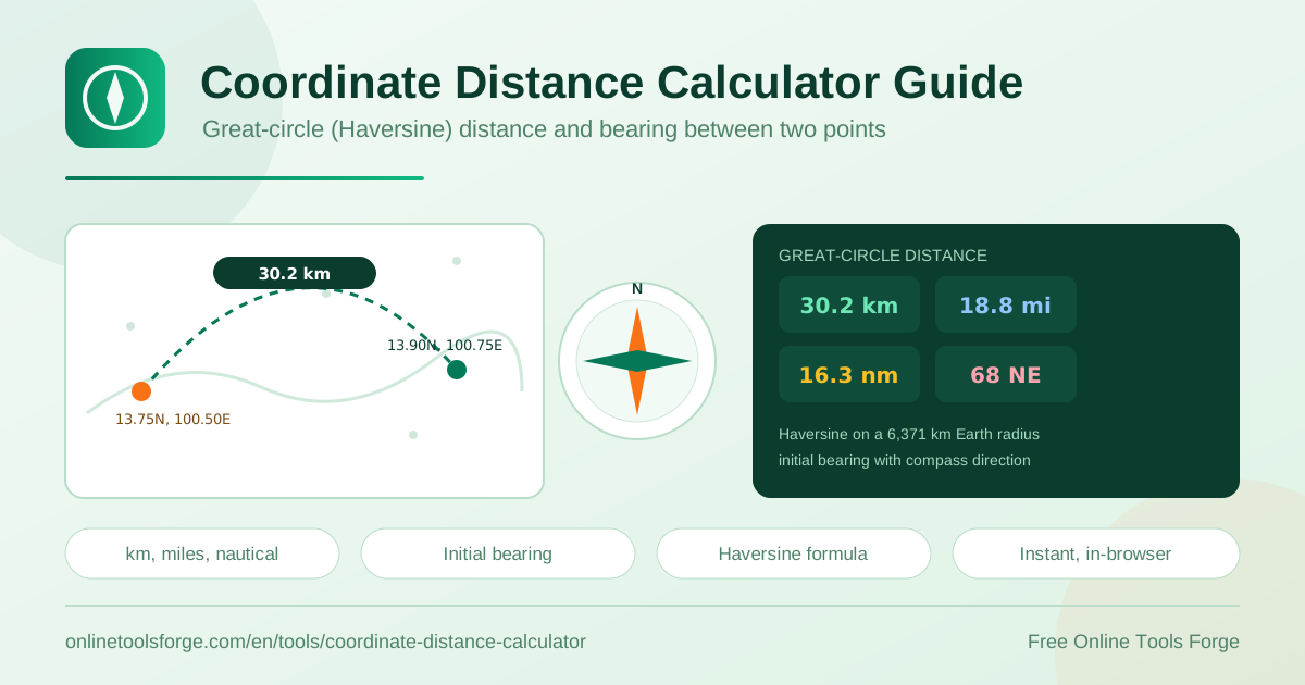
Table of Contents
Need to know exactly how far apart two points on Earth are? The free coordinate distance calculator computes the great-circle distance between any two latitude and longitude pairs in seconds. Enter two lat/lng points and the tool returns the distance in kilometers, miles, and nautical miles, plus the initial bearing with a compass direction such as NE or SW. Everything runs entirely in your browser: no signup, no upload, and no waiting.
Because the Earth is curved, the shortest path between two points is not a straight line drawn on a flat map. It is an arc along a great circle. The calculator applies the Haversine formula on a sphere of radius 6,371 km to produce that as-the-crow-flies figure, which is the number pilots, sailors, dispatchers, and GIS analysts actually rely on for flight legs, radio range, and geofencing decisions.
This guide explains what the tool measures, how the math works, and where a great-circle figure beats a map ruler.
Why Use the Coordinate Distance Calculator?
- True great-circle accuracy. Distances follow the curvature of the Earth rather than the distortion of a flat map projection, so results line up with what aviation and marine navigation tools report.
- Three units at once. Kilometers, miles, and nautical miles appear together, so you never need a separate unit converter for aviation or maritime work.
- Bearing included. The initial bearing in degrees plus a compass label (N, NE, E, SE, S, SW, W, NW) tells you exactly which way to head from the first point.
- Instant and private. Results appear in the browser as you type, and your coordinates never leave your device.
- No signup or install. The tool is free, needs no account, and works on desktop, tablet, and phone.
- Simple input. Four fields in decimal degrees for two points, and that is all the setup required.
Key Features
| Feature | What it does |
|---|---|
| Two lat/lng inputs | Accepts any pair of latitude and longitude points in decimal degrees |
| Haversine distance | Computes the great-circle distance on a 6,371 km mean-radius Earth |
| Kilometers result | The standard metric figure used by most GIS and mapping software |
| Miles result | Statute miles for US-friendly reporting and general comparison |
| Nautical miles result | The unit of record in aviation and marine navigation |
| Initial bearing | Departure heading in degrees with a compass direction label |
- The bearing is the course at the starting point only; the heading shifts continuously as you travel along the great circle.
- Results update with every keystroke, which makes it easy to compare candidate points side by side.
- Because the math runs client-side, the page even keeps working once you are offline.
How to Measure Distance Between Coordinates
- Open the coordinate distance calculator in your browser. No account or installation is needed.
- Enter the latitude and longitude of your first point. Positive latitude is north and negative is south; positive longitude is east and negative is west.
- Enter the latitude and longitude of your second point in the same decimal-degree format.
- Read the results immediately: the great-circle distance appears in kilometers, miles, and nautical miles.
- Note the initial bearing and compass direction if you also need a heading, then tweak either point to test alternate locations or radii.
How the Haversine Formula Works
A ruler on a paper map, or the measure tool on a typical web map, computes distance in projection space. Projection space is flat, but the world is not, and the flattening stretches length by an amount that grows with distance and latitude. A straight line on a Mercator map is not the shortest path across the planet. The genuine shortest path is the great-circle arc: the line you would trace on the surface of a globe.
The Haversine formula turns both points into angles on a sphere, takes the haversine of the latitude difference and the longitude difference, combines them with the cosines of the latitudes, and recovers the central angle between the points. Multiply that angle by the sphere radius and you have the arc length.
a = hav(dLat) + cos(lat1) * cos(lat2) * hav(dLon)
c = 2 * asin(sqrt(a))
d = R * c          # R = 6,371 km mean Earth radius
The 6,371 km constant is the mean radius of the Earth. The real planet is slightly flattened at the poles, so Haversine can drift by up to roughly half a percent at extreme distances. Geodetic methods such as Vincenty shrink that error, but for radius checks, flight planning estimates, and geofencing, Haversine remains the standard trade-off between accuracy and simplicity.
Remember that the answer is an as-the-crow-flies figure. Road distance is always equal or longer because highways curve around terrain and cities. Use great-circle distance for air and sea legs, service radii, and coverage questions; reach for a routing engine when drive time matters.
The initial bearing answers a different question: if I leave the first point on the shortest path, which compass direction do I start on? It is the departure heading only, because the course curves continuously along a great circle. That curvature is why long-haul flight paths on a flat map bend toward the poles.
Practical Use Cases
Flight and Shipping Legs
Estimate the great-circle length of an air corridor before quoting transit time, or compare alternative cargo routings leg by leg. A planner can sum legs in nautical miles to approximate fuel burn, while a travel blogger can sanity-check how far an itinerary really stretches.
Delivery Radius and Geofencing Checks
Measure the straight-line distance from your depot to a customer address to see whether it falls inside a promised service radius. The same check validates geofence alerts: if a reported entry sits 12 km from a 10 km fence, the trigger data deserves a second look.
Verifying GPS Logger Data
Logs from fitness watches, drones, and vehicle trackers sometimes contain spikes from lost signal. Spot-check a suspicious waypoint against the previous one: if the implied distance would demand an impossible speed between timestamps, that fix belongs in your data-cleanup script.
Antenna and Radio Line-of-Sight Planning
Amateur radio operators and wireless network planners use lat/lng separation to size link budgets between sites. Distance plus initial bearing tells you where to point a directional antenna and whether a path is plausible before anyone climbs a tower or a roof.
Best Practices
- Use decimal degrees consistently; mixing degrees-minutes-seconds values into a decimal field silently skews every result.
- Keep the signs straight: negative latitude means south and negative longitude means west.
- Geocode street addresses to coordinates first, then measure; the calculator expects numbers, not place names.
- Treat the output as surface distance and add margin for roads, terrain, and airspace restrictions.
- For short distances, input precision dominates; four or five decimal places (about 10 meters) is plenty.
- For critical figures such as contract radius limits, cross-check one pair with a second measurement or a known benchmark.
Start Measuring in Seconds
There is no reason to eyeball a map and hope. Open the free coordinate distance calculator, paste in two coordinate pairs, and get kilometers, miles, nautical miles, and the initial bearing instantly, right in your browser. Bookmark it for your next route plan, geofence audit, or antenna build, and share it with the colleague who keeps asking how far apart two places are.
Related Tools You Might Like:
- GPS Coordinate Converter — switch coordinates between decimal degrees, DMS, and other formats.
- Sunrise and Sunset Calculator — plan daylight windows for any location and date.
- Fuel Cost Calculator — turn a route distance into a realistic fuel budget.
Happy measuring!
Frequently Asked Questions
Q: Does the calculator measure road or driving distance?
A: No. It returns the straight-line great-circle distance across the surface of the Earth, which is always shorter than any road route. Use a routing service when you need driving distance or drive time.
Q: Why do kilometers, miles, and nautical miles all differ for the same trip?
A: They are different units for one distance. One nautical mile equals exactly 1.852 kilometers, so the three figures always convert consistently.
Q: How accurate is the Haversine calculation?
A: On the mean-radius sphere used here, results are typically within about half a percent of geodetic values, which is more than enough for range checks, flight estimates, and geofencing.
Q: What does the initial bearing tell me?
A: It is the compass heading at your starting point for the shortest path to the second point. Because great circles curve, the heading changes continuously along the way.
Q: Are my coordinates sent anywhere?
A: No. The tool runs entirely in your browser, so your coordinates never leave your device.