GPS Coordinate Converter: Turn Decimal Degrees into DMS and DDM Instantly
Convert GPS coordinates between decimal degrees, DMS and DDM formats instantly in your browser. A practical guide to coordinate dialects, conversion math, and best practices.
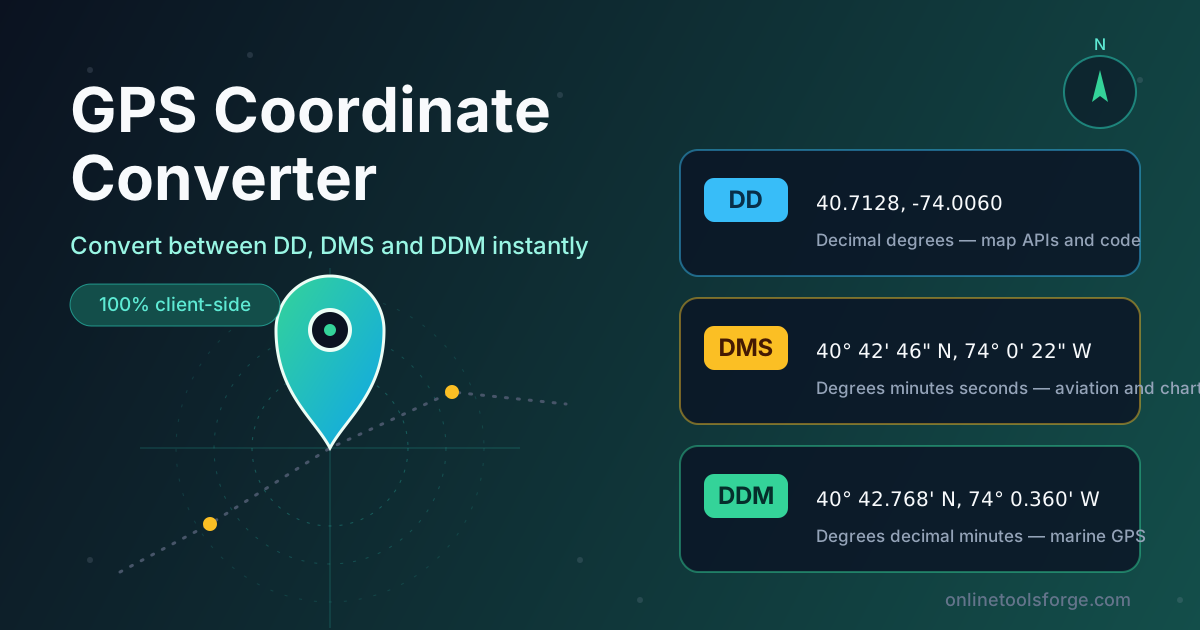
Table of Contents
GPS Coordinate Converter: Turn Decimal Degrees into DMS and DDM Instantly
One spot on the planet has exactly one location, yet almost every device writes it differently. GPS units, maps, and aviation forms all speak different coordinate dialects: your phone shows decimal degrees like 40.7128, an aviation chart prints 40° 42' 46" N, and a marine plotter reads 40° 42.768' N. Moving a location between them by hand is slow, and one misplaced digit puts you kilometers off target.
That is what the free GPS Coordinate Converter is for. Paste coordinates in decimal degrees (DD), degrees minutes seconds (DMS), or degrees decimal minutes (DDM), and the tool recognizes the format, converts it, and shows all three representations instantly. A forgiving parser handles flexible spacing, optional symbols, hemisphere letters, and sign conventions, so you can enter coordinates exactly as you found them.
Everything runs 100% in your browser — nothing is uploaded and no account is required. This guide covers the features, the math behind the formats, and where conversions save real time.
Why Use GPS Coordinate Converter?
- Speak every coordinate dialect. Whether a document hands you DD, DMS, or DDM, translate it into the format your GPS unit, mapping API, or paperwork expects — no formula hunting.
- Tolerant, forgiving parsing. Flexible spacing, optional symbols, and hemisphere letters before or after the numbers all work, so messy real-world input still parses.
- No misreading of decimals. Lookahead guards prevent errors like splitting 40.7128 into 40 degrees, 71 minutes, and 28 seconds — a classic naive-converter mistake.
- Instant three-way results. Type once and see all three formats at once, so you can confirm the values you copy are the ones you intended.
- Hemisphere handled correctly. Enter S/W letters or negative numbers; sign conventions apply consistently, so a southern point never lands in the north.
- Private and free. Everything runs client-side in your browser — no sign-up, no limits, and no coordinate data ever leaves your device.
Key Features
| Feature | What it does |
|---|---|
| Three-way conversion | Converts between decimal degrees (DD), DMS, and DDM and shows all formats at once |
| Tolerant parser | Accepts flexible spacing, optional symbols, and hemisphere letters in leading or trailing position |
| Lookahead guards | Prevents decimal values from being mis-split into degree, minute, and second components |
| Sign conventions | Treats negative values as south latitude or west longitude, and normalizes hemisphere letters |
| Instant updates | Results recompute as you type, with no button to press and no page reload |
| 100% client-side | All math runs in your browser; no network requests, no data collection |
The lookahead guards matter more than they sound: without them, a converter can quietly read 40.7128 as forty degrees, seventy-one minutes, twenty-eight seconds — a point hundreds of kilometers away. Sign convention support means 74.0060 W and -74.0060 produce identical results.
How to Use
- Open the tool at GPS Coordinate Converter.
- Paste or type your coordinates in any format — 40.7128 -74.0060, 40° 42' 46" N 74° 0' 22" W, or 40° 42.768' N 74° 0.360' W all parse cleanly.
- Review the converted values, which update instantly in all three formats as you type.
- Check the hemisphere — if the input was a bare negative, confirm south or west is what you meant before copying.
- Copy the format you need into your GPS unit, code, form, or document.
DD, DMS, and DDM Explained
The three formats slice the same angle differently; here is what each one is, who uses it, and how the math connects them.
Decimal degrees (DD) expresses latitude and longitude as plain numbers: 40.7128, -74.0060. As single floating-point values, DD is the native language of programming and most map APIs — Google Maps, Leaflet, GeoJSON, and nearly every database store coordinates this way.
Degrees minutes seconds (DMS) divides each degree into 60 minutes and each minute into 60 seconds, written like 40° 42' 46" N. It is the traditional notation of aviation, surveying, and printed charts, where the nested structure makes positions easy to read off gridded paper.
Degrees decimal minutes (DDM) splits the difference: degrees plus minutes carried to decimal places, as in 40° 42.768' N. It is the default display on most marine GPS units: compact, easy to read aloud over a radio, and free of the seconds field.
The conversion math is simple once you see it. To go from DD to DMS, keep the whole degrees, multiply the remaining fraction by 60 for minutes, then multiply the leftover fraction by 60 again for seconds. For 40.7128° N:
- Whole degrees: 40
- Minutes: 0.7128 × 60 = 42.768, so 42 whole minutes
- Seconds: 0.768 × 60 = 46.08, which rounds to 46
That gives 40° 42' 46" N — the same point, written traditionally. Going back is division: 40 + 42/60 + 46/3600 = 40.71278°, matching the original to four decimals. DDM stops after the first multiplication, so 40.7128° becomes 40° 42.768'.
Hemisphere sign conventions keep this unambiguous: north and east are positive, south and west negative. So 74.0060° W is stored as -74.0060, and Sydney sits near -33.8688 latitude. The tool accepts either a negative number or an explicit letter, so 40° 42' 46" S and -40.7128 refer to the same place.
Precision has a physical meaning. One degree of latitude is about 111 km, so the fourth decimal is worth roughly 0.0001° ≈ 11 m — about a building's width. Four decimals find a street address, five put you within about a meter, and six approach survey-grade accuracy.
Practical Use Cases
Entering Waypoints into a Handheld GPS
Handheld and marine GPS units each default to a particular display format, and a waypoint from a website or paper map often arrives in another. Convert first, set the GPS to the matching format, then key the numbers in — ten seconds that prevent saving a waypoint minutes off target.
Geocaching
Cache listings publish coordinates in DDM, many phone apps prefer DD, and older puzzle caches mix formats freely. Paste the listing into the converter, read off the format your app wants, and head out confident you are heading to the published spot.
Real Estate and Survey Documents
Deeds, survey reports, and planning applications frequently record parcel corners in DMS, while county GIS portals and mapping tools expect decimal degrees. Converting between the two lets you cross-check that the corner on paper is the corner you are standing on.
Drone Flight Logging
Regulators and flight-log templates in different countries ask for coordinates in different notations, and pilots often hold waypoints in one format while their logging app expects another. Keeping a converter open means every flight record and form uses the exact notation it demands.
Best Practices
- Keep five or six decimal places when working in DD; fewer lose meaningful precision, and more add only noise.
- Always state the hemisphere. Use N/S and E/W or signed values consistently — never leave a latitude to be guessed from context.
- Never mix up latitude and longitude order. Most APIs expect latitude first; most people say longitude first — confirm before pasting, or your point ends up in the wrong ocean.
- Verify against a known landmark. Plot the result on a map and compare it with a place you recognize before trusting it in the field.
- Convert once, then stay in one format for the rest of a session to avoid compounding rounding differences.
Start Converting Today
Coordinate formats should never stand between you and a correct location. The GPS Coordinate Converter handles DD, DMS, and DDM in one place, instantly and entirely in your browser — free, with no sign-up and no data leaving your device. Paste your next coordinates and see all three formats in a heartbeat.
Related Tools You Might Like:
- GeoJSON Converter — convert coordinate and geospatial data between GeoJSON, KML, and other formats.
- Unit Converter — handle length, mass, volume, and other everyday unit conversions with ease.
- Timezone Converter — line up times across zones when planning field work across regions.
Happy navigating!
Frequently Asked Questions
Q: What is the difference between DD, DMS, and DDM coordinates?
A: They are three notations for the same angle: DD as a single decimal number (40.7128), DMS as degrees, minutes, and seconds (40° 42' 46"), and DDM as degrees plus decimal minutes (40° 42.768'). The underlying point never changes.
Q: Why do western and southern coordinates use negative numbers?
A: By convention, latitude is positive north of the equator and negative south, while longitude is positive east of the prime meridian and negative west — so 74.0060° W is written -74.0060 in decimal degrees.
Q: How many decimal places do I need in decimal degrees?
A: For everyday use, five is plenty. Each 0.0001° is roughly 11 meters, so four decimals find a building and five put you within about a meter.
Q: Can I paste coordinates with hemisphere letters like N, S, E, W?
A: Yes — letters before or after the numbers, with or without the degree symbols, and with flexible spacing. Plain negative values work too, under the same sign conventions.
Q: Is my location data uploaded anywhere when I use the converter?
A: No. The conversion runs entirely in your browser. Nothing you type is transmitted, stored, or logged.